-Sharply Curved Yoshinogawa River-
Ikeda Area

The Yoshinogawa River: A Geological Force Behind Culture in Northeastern Shikoku Island

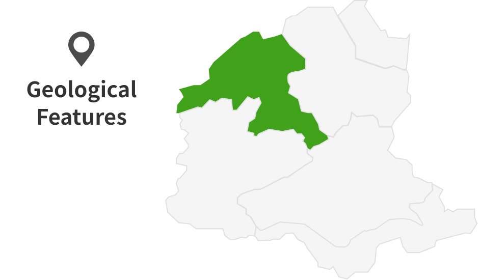
Ikeda Area
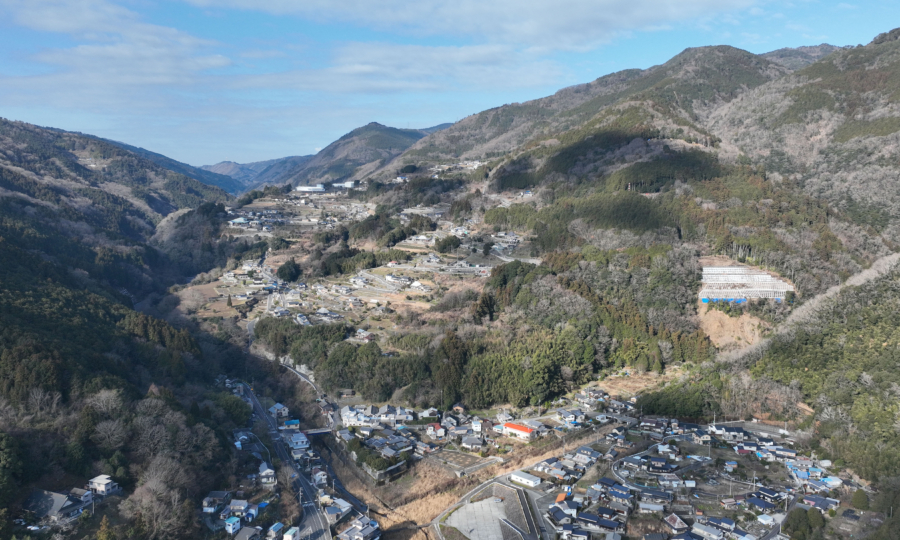
In the Ikeda Area, the Yoshinogawa River changes its course—a shift that has played a key role in shaping the local culture of northeastern Shikoku island, including Tokushima Prefecture. Running east to west through this area is the Median Tectonic Line (MTL). Movements along the MTL have created uplifted land, cliffs, and mountains, which in turn altered the river’s flow. The dramatic transformation of the landscape began around 3 million years ago.
Geological Processes that Changed the Flow of the Yoshinogawa River
*View of the northern part of the river from the south
-
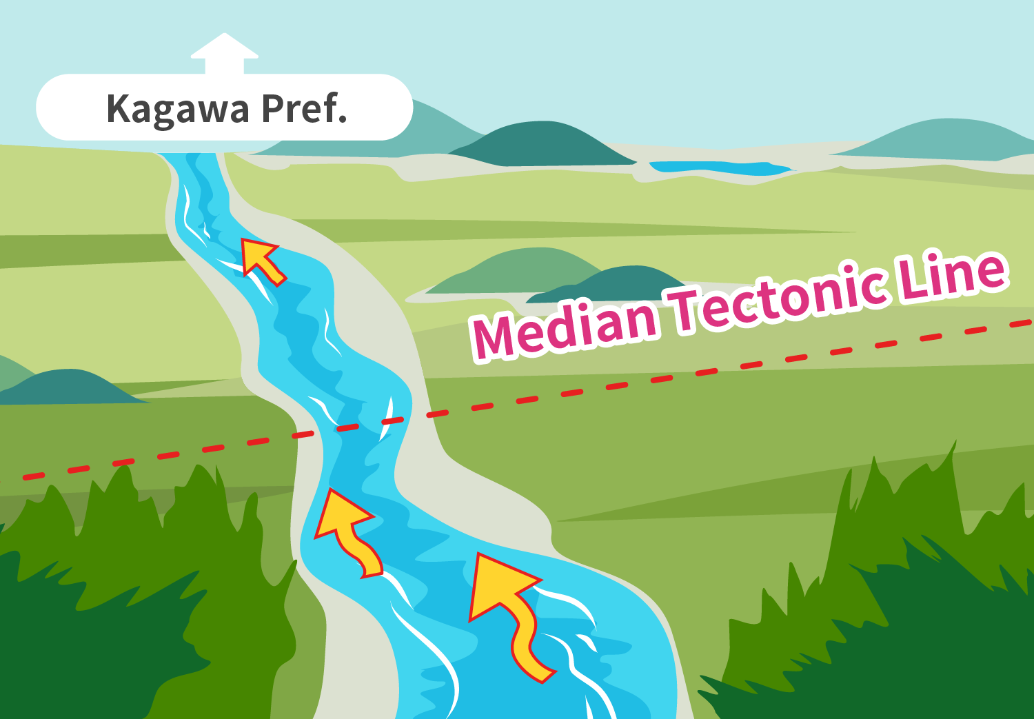
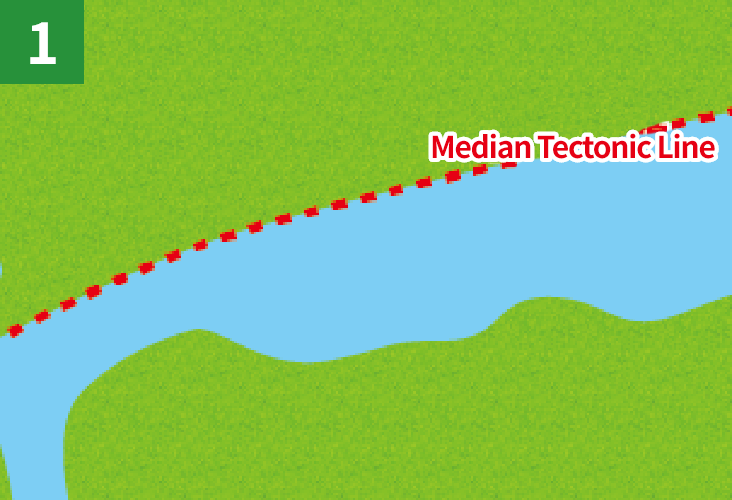
Before 3 million years ago
At this time, the Sanuki Moutain Range had not yet formed, and the Yoshinogawa River flowed northward into what is now Kagawa Prefecture.
The MTL had not yet begun its current movement pattern (right-lateral slip and uplift on the northern side), so the river continued its northward course.
-
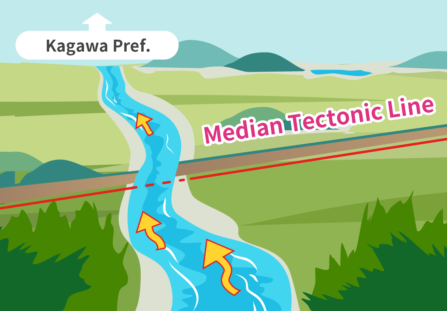
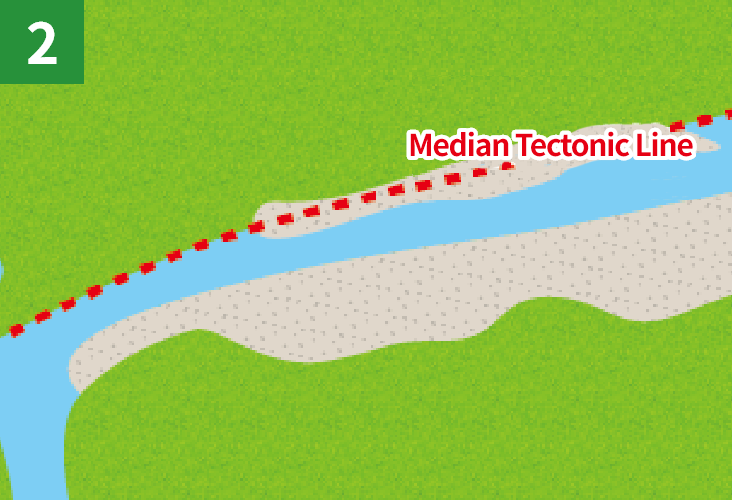
About 3 million years ago
The MTL began to slide, causing repeated right-lateral slip and uplift in the northern part of the MTL. These tectonic movements led to the formation of the Sanuki Mountain Range.
About 3 million years ago, the Philippine Sea Plate changed its direction of movement. This shift affected the MTL, altering its motion to a right-lateral slip combined with uplift on the northern side. Despite these tectonic changes, the river still continued to flow northward at that time.
-
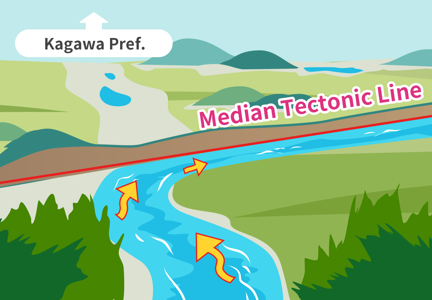
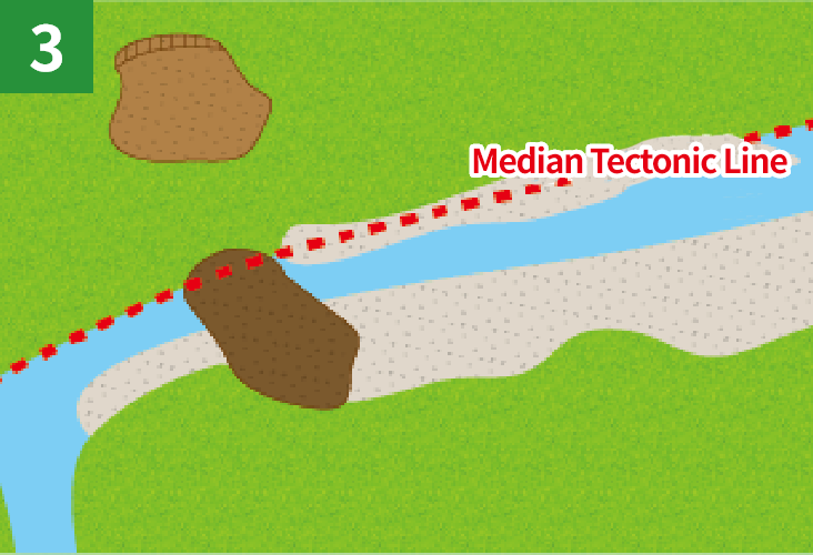
1-2 million years ago
The river’s northward flow drastically changed direction and began to flowing eastward.
The repeated slip movements of the MTL continued to uplift the northern part of the MTL, which eventually changed the river’s flow direction.
-
Present Day
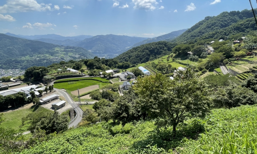
The change in the Yoshinogawa River’s flow direction has played an important role in shaping the diverse cultures found in Kagawa Prefecture and Tokushima Prefecture today.
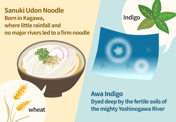
Kagawa Prefecture receives little rainfall, partly because the Sanuki Mountain Range, located on the northern side of the MTL, has gradually risen in elevation. In addition, the region lost a major river, making it difficult to secure a stable water supply. As a result, Kagawa Prefecture developed wheat-based agriculture, leading to the production of udon noodles, now a signature local dish. Meanwhile, in Tokushima Prefecture, the Yoshinogawa River is prone to flooding. The nutrient-rich soils deposited by these floods created ideal conditions for growing indigo plants, which became the raw material of indigo dyeing—a major industry in Tokushima’s history.
What happened after the river curved itself? – How the land of Ikeda formed?
Bird-eye’s view
-
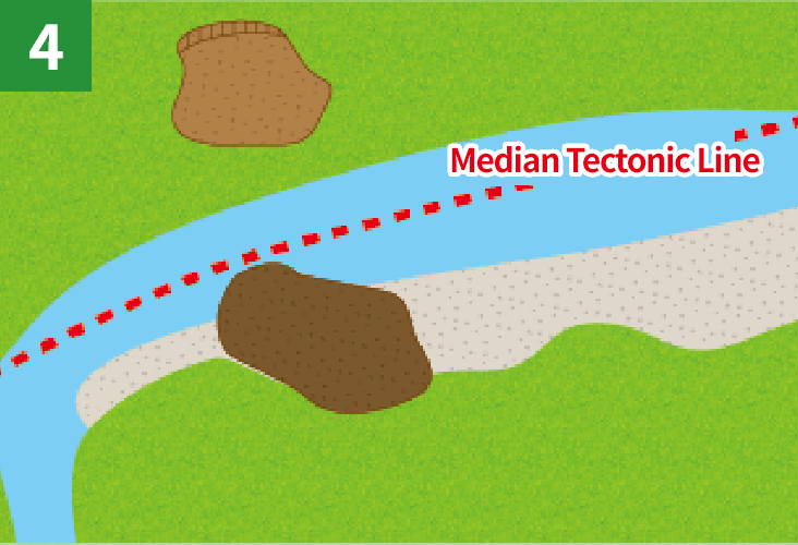
The river changed its course to the east
-
Flat lands began to form.
-
Soils from the Sanuki Mountain Range blocked the river.
-
The river flowed north of Shinyama
-
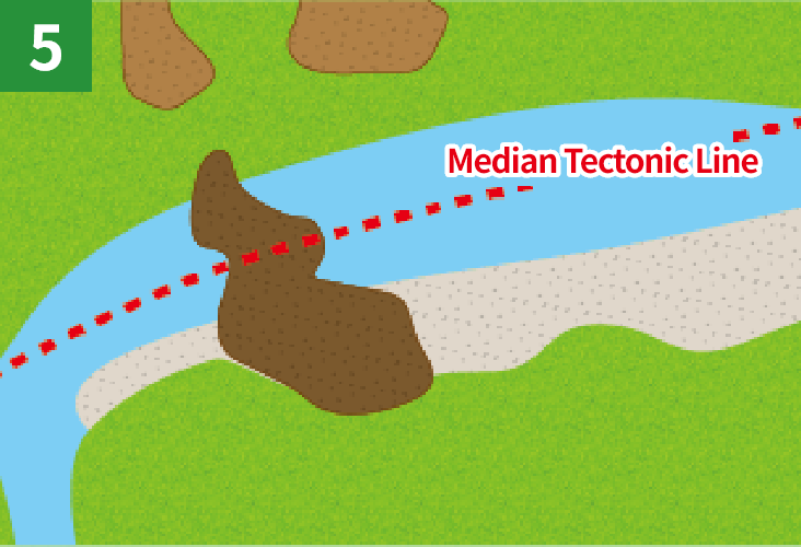
Soils from the Sanuki Mountain Range formed Maruyama
-
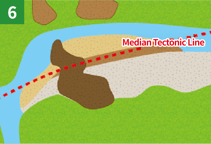
The river flowed north of Maruyama and flat lands, plateaus, and fault scarp formed in Ikeda.
Let’s all work together to preserve the landscapes and natural environment of the area. Each of us has a responsibility to protect our great Earth. Please do not litter and refrain from taking rocks and plants. Thank you for your cooperation.
*Part of this area is protected by laws and regulations. Please follow the rules to conserve the natural environment.
Site List of Ikeda Area
Geosites
Geosites are specific spots where geological features are found and need to be protected.
Fault Scarp Formed by Ikeda Fault
In downtown Ikeda, you might notice some changes in elevation. One of the most noticeable is a 20–30 meter-high cliff between the Ueno and Machi-Sarada districts. The fault scarp was formed by the Ikeda Fault of the Median Tectonic Line, an active fault system and runs directly beneath the fault scarp from east to west. When the Ikeda Fault moved, the land on the northern side was pushed up by several tens of centi meters, and the fault scarp also shifted sideways by a few meters. These movements happened many times over a long period, gradually creating the fault scarp we see today.
The Median Tectonic Line in Shuzu Area
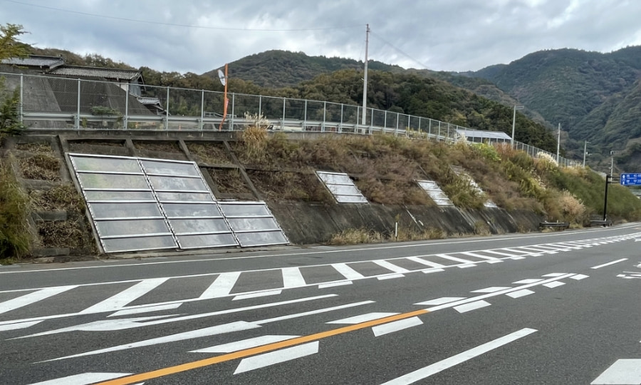
Along National Route 32 (also known as Inohana Road), on the way from Shuzu of Ikeda Town toward Kagawa Prefecture, you can see outcrops of the Ikeda Fault—part of the active Median Tectonic Line, an active fault system. These outcrops are protected by transparent display boards. The southernmost board shows the actual surface of the fault. As you move north, the outcrops show less intense fault-related fracturing. On the southern side of the fault, you will find layers of conglomerate deposited in the Yoshinogawa River. Here, you can see fault-fracture zones of the Izumi Group.
*Please note: There is no sidewalk near the display boards, and approaching them is not allowed. For your safety, please view the outcrops from across the road.
Shinyama Formed by Ancient Landslide Blocks
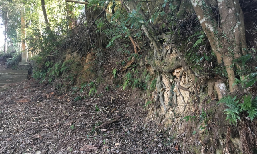
The Median Tectonic Line (MTL) is a major fault that separates different types of geological formations. North of the MTL, the land is mostly made up of sandstone and mudstone, while the southern side is mainly crystalline schist. However, Shinyama—a low, gently sloping hill located on the southern side—is also made up of sandstone and mudstone. This is unusual, because it does not match the typical geology of the area. The reason is that landslides from the Sanuki Mountain Range, located to the northern side, once crossed over the MTL and deposited these materials of landslide blocks on the southern side. This is how the land of Shinyama Area was made.
Landslide Topography in Nishiyama
Nishiyama Village is one of several settlements located in the middle of the Sanuki Mountain Range. The village sits on gentle slopes that were formed by past landslides.
Landslide Topography in Inokubo
It is believed that past landslides once blocked the Umajigawa River, located to the south. Today, the river is unusually narrow—one of the clues that suggest it was once dammed by landslides.
Outcrop of the Fluvial Terrace in Nakanishi
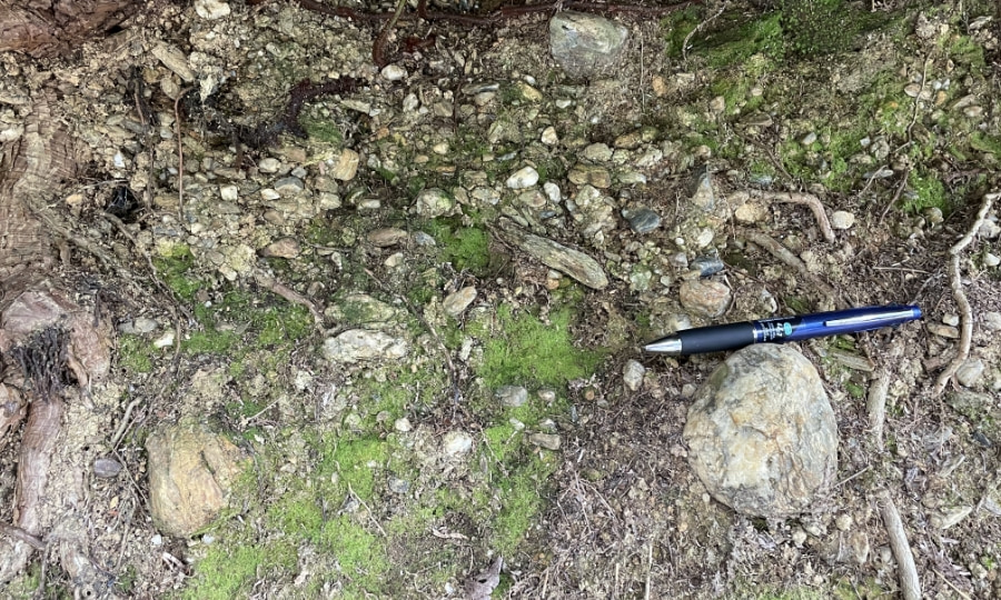
In the Nakanishi District of Ikeda Town, you can see layers of conglomerate made up of various shapes and sizes. These layers were formed by the Yoshinogawa River's flow, which made up the fluvial terrace.
Cultural Sites
Cultural Sites are specific spots where cultural heritage has been shaped by geological features and need to be protected.
The Stone Wall at Ikeda Castle Ruins
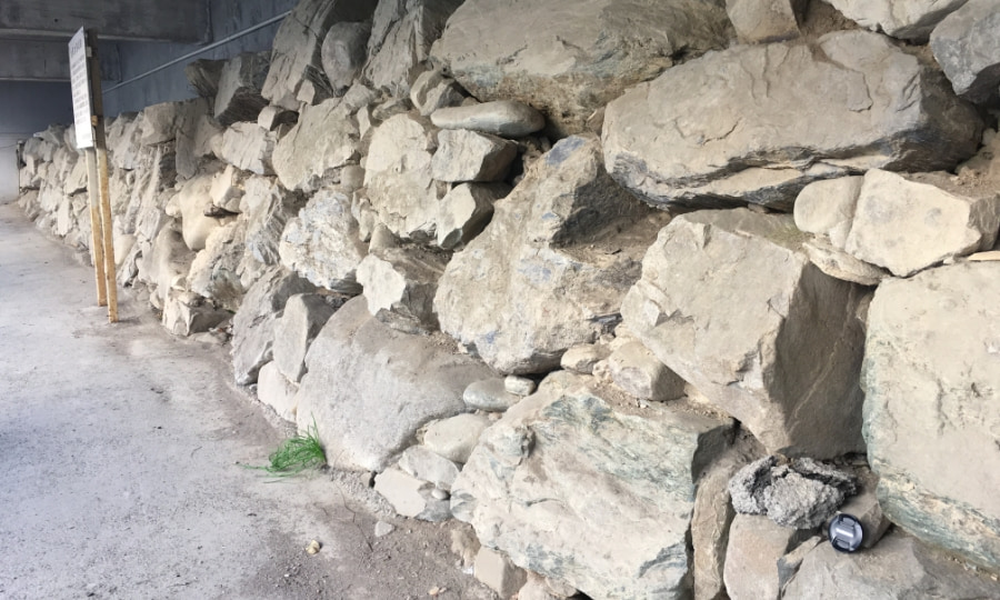
Ikeda Castle, known as one of the Awa Nine Castles, was dismantled following the 1638 law that limited each province to just one castle. The remaining stone walls showcase traditional construction techniques from the 1600s. Interestingly, the stones used come from both sides of the Median Tectonic Line; crystalline schist from the south and sandstones from the south.
Tall Lantern at Hashikura Temple
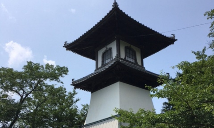
Hashikura Temple is located in the middle of the Sanuki Mountain Range. Along the temple’s approach stands at a very tall lantern. This lantern once served as a kind of “river lighthouse,” guiding boats traveling along the Yoshinogawa River at night, from downstream to upstream.
Spring Water in Hakuchi
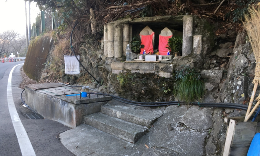
At the base of the Hesokko Ohashi Bridge, spring water flows up from underground—considered by some to be gifted from the movements of the Median Tectonic Line. Around the MTL, layers of crushed rock mixed with groundwater create sticky, clay-like barriers that naturally hold water back. The spring appears slightly away from these layers, where water finds a path to the surface. In the past, local people used this spring water for hot springs or onsen.
Ecosites
Ecosites are specific spots where ecosystems have been shaped by geological features and need to be protected.
Kurozo Marshland and Surrounding Forests
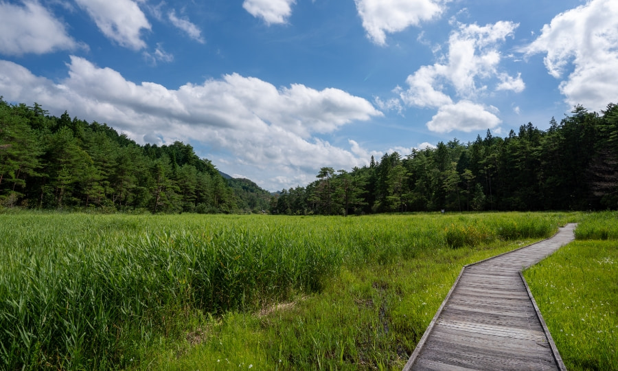
Kurozo Marshland is home to a variety of plants and animals adapted to marshland environments. Some rare species of plants and dragonflies can be found here. The marshland is shaped by several factors: 1) flat terrain and water flowing in from nearby mountains, 2) high elevation and cold temperatures, and 3) surrounding Japanese red pine (Pinus densiflora) forests, which lead to poor soil conditions and inhibit the growth of other tree species. These conditions help preserve the unique ecosystem of Kurozo Marshland.
- HOME
- Miyoshi Geopark Areas
- Ikeda Area