‘Hidden Scenic Spot:’ Clinging to the Mountain Slopes
Iya Area

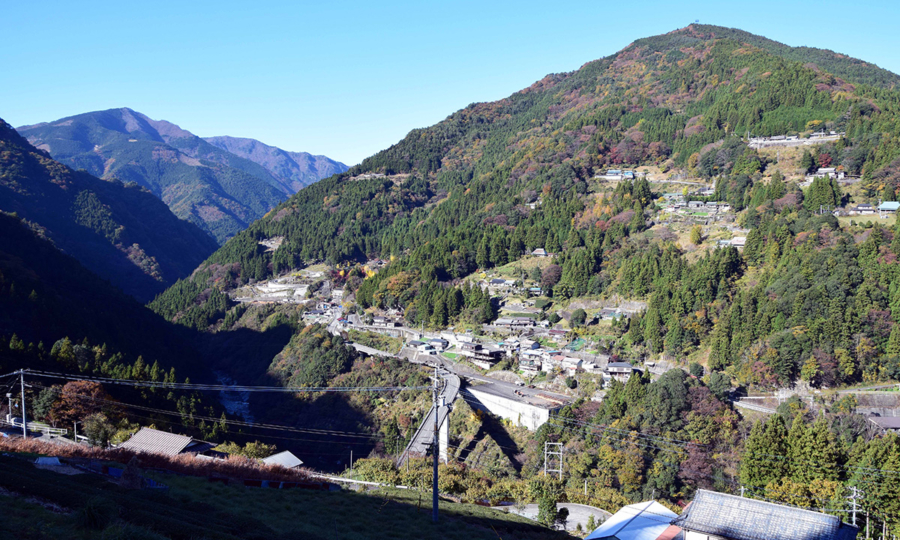
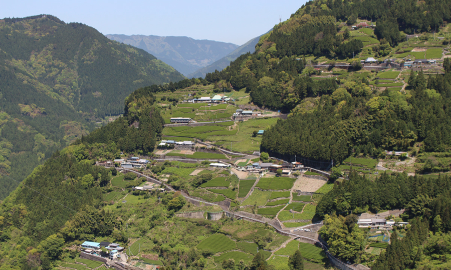
Scenery Created by Villages on Mountain Slopes

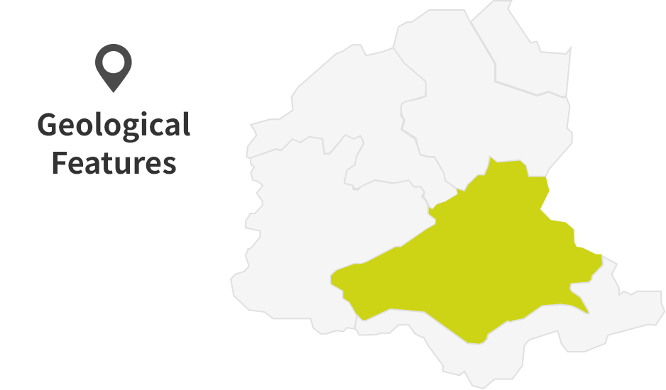
Iya Area
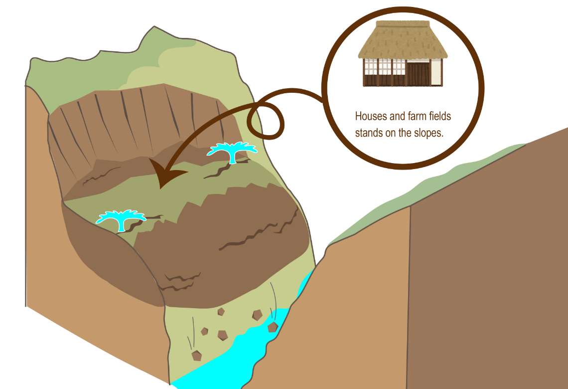
The Iya Area is located in the middle to upper reaches of the Iyagawa River. Several settlements have been established on the mountain slopes along the river. These villages, clinging to steep slopes, live close to nature and still retain much of the traditional wisdoms and lifestyles. They are built on relatively gentle slopes compared to other parts of the mountains. These gentle slopes were formed by significant land movements in the past.
What Created the Villages on the Mountain Slopes?
The gentle slopes that serve as the foundation for today’s villages were shaped by past landslides.
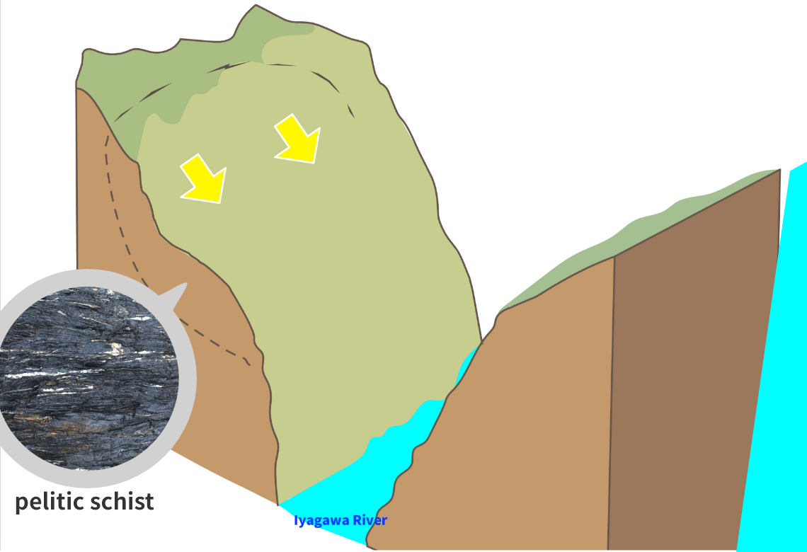
Landslides are more likely to happen on terrain made up of weak layers of pelitic schist and steep landscapes.
These landslides have softened the mountain slopes, and sometimes spring water emerges from them.
Let’s all work together to preserve the landscapes and natural environment of the area. Each of us has a responsibility to protect our great Earth. Please do not litter and refrain from taking rocks and plants. Thank you for your cooperation.
*Part of this area is protected by laws and regulations. Please follow the rules to conserve the natural environment.
Site List of Iya Area
Geosites
Geosites are specific spots where geological features are found and need to be protected.
Landslide Topography in Zentoku and Imakubo
Landslide topography is commonly found throughout the Sikoku Mountains, especially in the Zentoku area, which has experienced repeated landslides over time. These events have gradually shaped the terrain into gentle slopes. Since future landslides are predicted in this area, the national government has provided preventive construction measures to reduce the risk.
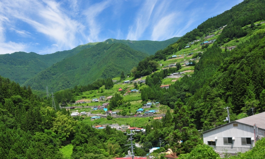
Landslide Topography in Aruse
Aruse Village, located near the border with Kochi Prefecture, is one of Tokushima’s most well-known tea-growing areas. Some parts of the village are currently experiencing active landslides. Here too, countermeasure construction is underway to help protect the area.
Cultural Sites
Cultural Sites are specific spots where cultural heritage has been shaped by geological features and need to be protected.
Check Dam Group in Tairadani
This group of check dams was built as the Tairadani Landslide Control Project. Because the geology around the site is very loose and soft, earlier check dams collapsed due to lateral pressure. Today’s check dam group in Tairadani is well-adoped to the around geology of the area. The unique construction method used in Tairadani has been selected as one of “60 Outstanding Forest Conservation Projects (Landslide Prevention Efforts) for Future Generations”
Ochiai Village
Ochiai Village has been designated as a National Preservation Districts for Groups of Traditional Buildings as "Higashiiya Yamamura Ochiai." The village is home to historic houses and stone walls built between the late 1800s and early 1900s on gentle mountain slopes formed by past landslides. These structures are considered valuable cultural heritage.
Kazurabashi Vine Bridge
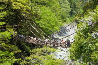
Kazurabashi Vine Bridge was once an important means of transportation, connecting remote villages. The bridge is made from the vines of Actinidia arguta (kiwi vines), which are naturally flexible when heated, strong, and resistant to insects—making them ideal for bridge construction. Today, Kazurabashi Vine Bridge remains designated as a National Important Tangible Folk Cultural Asset.
Giant Cedar Tree at Gosho Shrine
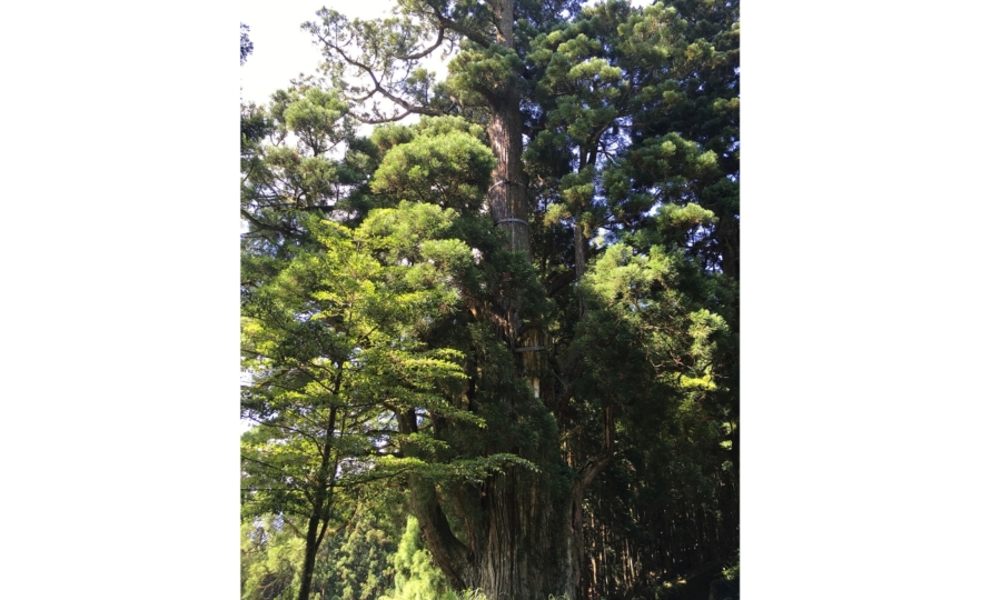
Gosho Shrine is located in Awashi Village, Nishiiya-yamamura, an area shaped by landslides. Within the shrine grounds stands a giant cedar tree(Cryptomeria japonica), measuring 12.20 meters in trunk circumference and about 30 meters in height. Believed to be over 1,000 years old, the tree is a symbol of the land’s long-standing stability. This sacred tree is designated as a Prefectural Natural Monument.
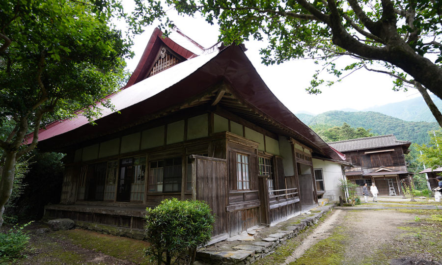
Asa House of Ancient Heike Warriors
Built on gentle slopes, this house once belonged to a village headman during the Middle Ages. It is a representative example of an upper-class peasant home in mountainous regions, featuring a main garden and stone walls. In 2000, it was designated as Prefectural Important Tangible Folk Cultural Asset.
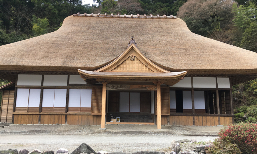
Tokuzen Residence
The Tokuzen Residence is one of the eight samurai houses of the Iya region and once belonged to a local leader who governed the area. It is built on a gentle slope formed by past landslides. The one-story wooden house features a traditional hip-and-gable thatched roof structure (now covered with metal sheets).
*Please note that entering the residence without permission is prohibited.
Ecosites
Ecosites are specific spots where ecosystems have been shaped by geological features and need to be protected.
Sasa grasslands in Ochiai Pass
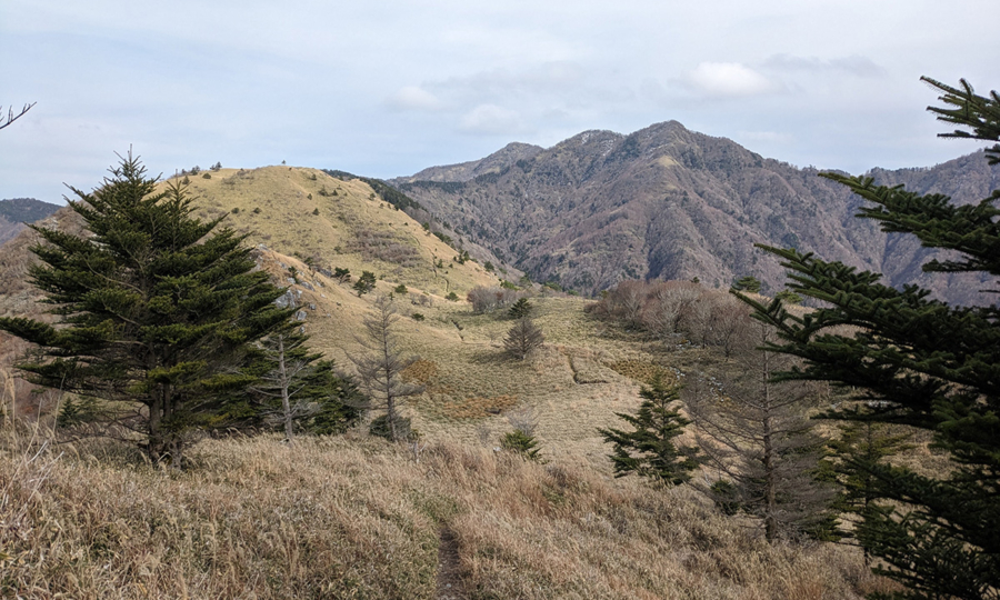
This area was once covered with Japanese pampas grasses (Miscanthus sinensis), but today, Miyamakumazasa (Sasa hayatae) dominates the landscape. Along the Ochiai Pass, you can also observe Tsurugimitsubatsutsuji (Rhododendron tsurugisanense), a species of azalea that is found only at high elevations in Shikoku island. Several depressions caused by landslides have formed wetlands, even at the top of the mountains.
- HOME
- Miyoshi Geopark Areas
- Iya Area