-The View of Flat Fields on the North Bank of the Yoshinogawa River-
Mino Area

Formation Processes of the North Bank of the Yoshinogawa River

Mino Area
Mino Area is located on the north bank of the Yoshinogawa River. The flat fields on the north bank, including Mino Town, has been formed by accumulated conglomerates and sands from the Yoshinogawa River and the Sanuki Mountain Range. Many alluvial fans are situated at the foot of the Sanuki Mountain Range, created by rivers flowing down from the mountains. The river flows at a higher elevation compared to other flat fields. The well-drained soils on the alluvial fans are ideal for growing various kinds of fruits and vegetables.
Formation Processes of the Flat Terrrain in Mino Town
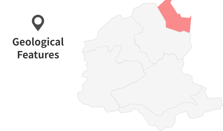
The slip direction of the MTL became the same as it is today (right-lateral slip), causing the land north of the MTL to rise.
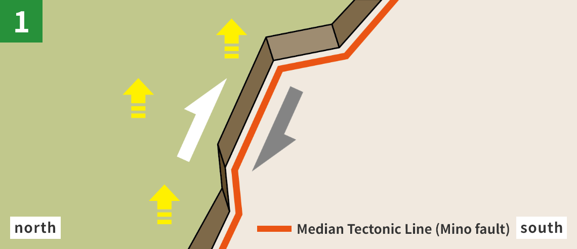
The Sanuki Mountain Range was formed due to the MTL movement.
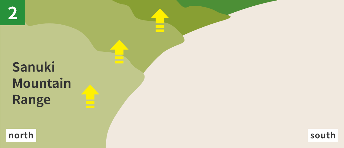
The Yoshinogawa River flowed between the Sanuki Mountain Range and the Shikoku Mountains, creating the flat fields.
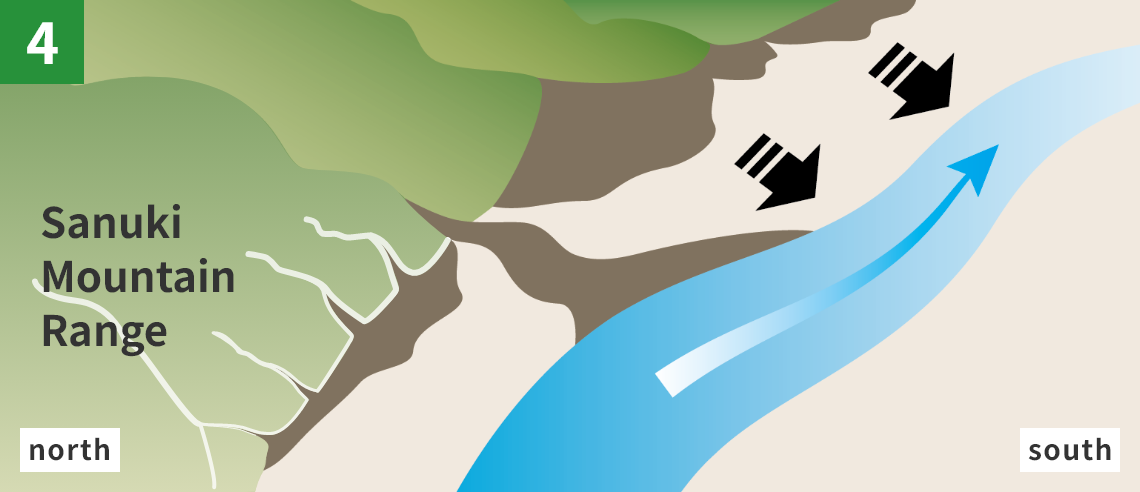
Conglomerates and sands from the Sanuki Mountain Range accumulated, forming several alluvial fans. This is how the flat fields on the north bank of the river spread.
Let’s all work together to preserve the landscapes and natural environment of the area. Each of us has a responsibility to protect our great Earth. Please do not litter and refrain from taking rocks and plants. Thank you for your cooperation.
*Part of this area is protected by laws and regulations. Please follow the rules to conserve the natural environment.
Site List of Mino Area
Geosites
Geosites are specific spots where geological features are found and need to be protected.
Outcrops of the MTL in Tachino
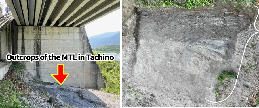
If you walk down the slope on the south side of the parking area at Roadside Station Mino, you will notice a section of land that has been excavated (marked with a red circle on the picture). This is where you can observe the fault fracture zone of the MTL, where rocks and clay have been shattered by fault movement. Because such exposures are rare, this site has been designated as a Prefectural Natural Monument.
*Please note that outcrops are fragile. Do not enter the depressed part of the ground. Thank you for your understanding.
Shibo Thrust Fault
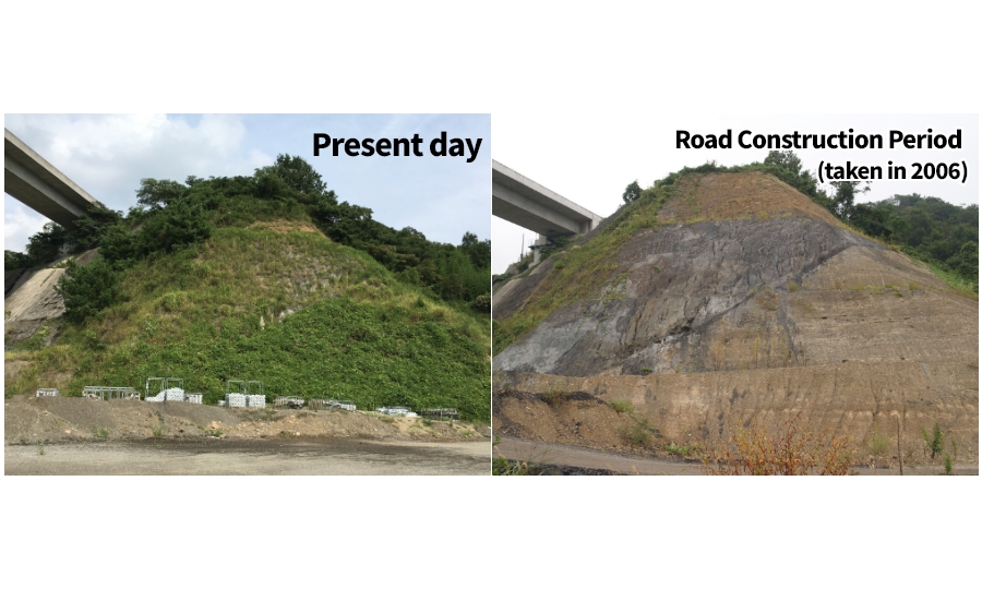
Near the Kouchidanigawa River, the Ikeda Fault and Mino Fault lie very close to each other. The two faults compose of the Median Techtonic Line. Like this, where major faults meet, several fault branches can often be observed. Shibo Thrust Fault is one such branch. Here, the greyish Izumi Group (seen in the upper left) has been thrust over the fault plane (seen in the lower right) at a shallow angle, forming a classic example of a thrust fault.
Ohji's Alluvial Fan
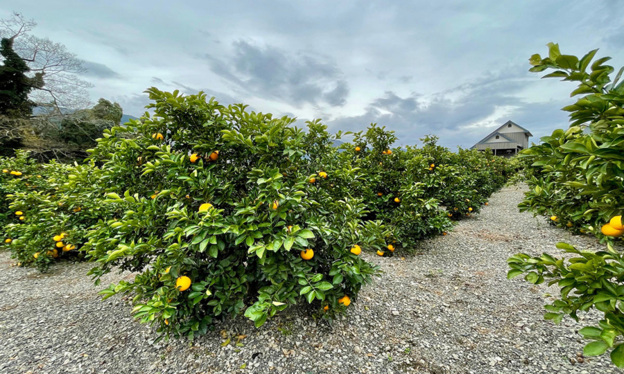
Around Ohji Elementary School, alluvial terrace has formed from conglomerates and sand carried by the Takitanigawa River. Mino Town, including Ohji district, enjoys abundant sunlight through the year. The well-drained alluvial fans—made up of materials from the Sanuki Mountain Range—provide ideal conditions for fruit farming. Citrus varieties fruits such as “Harehime” and “Hassaku” are successfully cultivated in this area.
- HOME
- Miyoshi Geopark Areas
- Mino Area