The Super Rugged Valleys!
Oboke-Koboke and Iya Valley Area

The Super Rugged Valleys in Shikoku Island

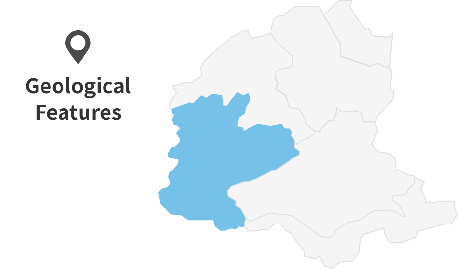
Oboke Koboke・Iya valley Area
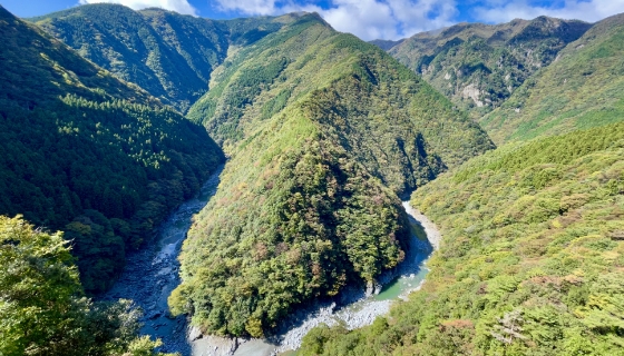
“Whoa, that’s steep!” – that’s the perfect way to describe the Oboke-Koboke and Iya Valley area.
Located in western Japan, the Shikoku Mountains are famous for their rugged terrain, and among them, Oboke-Koboke and the Iya Valley are the some of the steepest and most dramatic spots. The name ‘boke’ in ‘Oboke-Koboke’ comes from an old Japanese word meaning “sheer cliffs along rivers.”
But what exactly made the valley so steep?
Why Are the Valleys So Rugged?
Hard Rocks Formed Deep Underground
The land of Oboke-Koboke Gorge is mainly made of psammitic schist and conglomerate schist. Around 100 million years ago, sands and conglomerates were deposited on the ocean floor. These layers were later pushed 10 to 20 kilometers underground, where they were compressed under intense pressure and turned into hard rock. This process resulted in the formation of schist. Over time, these rocks (schist) were uplifted and now form the land of Oboke-Koboke Gorge we see today.

Three Key Factors Behind the Rugged Terrain
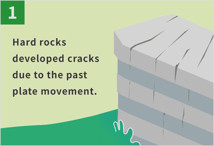
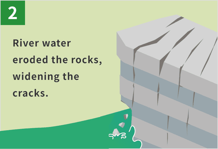
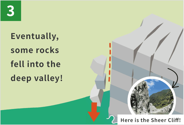
1) Hard rocks that crack vertically, 2) the rise of the Shikoku Mountains, and 3) the powerful flow of the Yoshinogawa River. These three natural forces worked together to carve out the steep, dramatic valleys of Oboke-Koboke and Iya. That is why the area is still known by the old word “boke,” meaning “sheer cliffs along rivers.”
Let’s all work together to preserve the landscapes and natural environment of the area. Each of us has a responsibility to protect our great Earth. Please do not litter and refrain from taking rocks and plants. Thank you for your cooperation.
*Part of this area is protected by laws and regulations. Please follow the rules to conserve the natural environment.
Site List of Oboke-Koboke and Iya Valley Area
Geosites
Geosites are specific spots where geological features are found and need to be protected.
Conglomerate Schist in Sanmyo and Iya
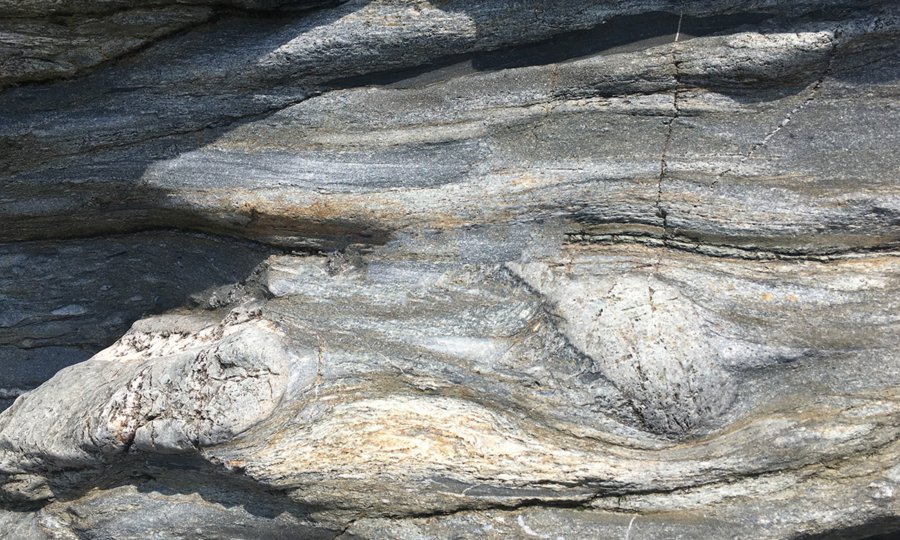
Oboke Gorge and Iya Valley contain a small amount of “conglomerate schist”—a type of crystalline schist that includes conglomerate. About 70 to 90 million year ago, layers of conglomerates were deposited on the ocean floor.
Due to tectonic plate movements, they were later pushed down to depths of around 15 kilometers underground.
There, under intense pressure, the conglomerates were stretched. Today, the area of Sanmyo and Iya clearly show evidence of this underground geological process. These unique rocks, known as conglomerate schist, have also been designated as a Prefectural Natural Monument.
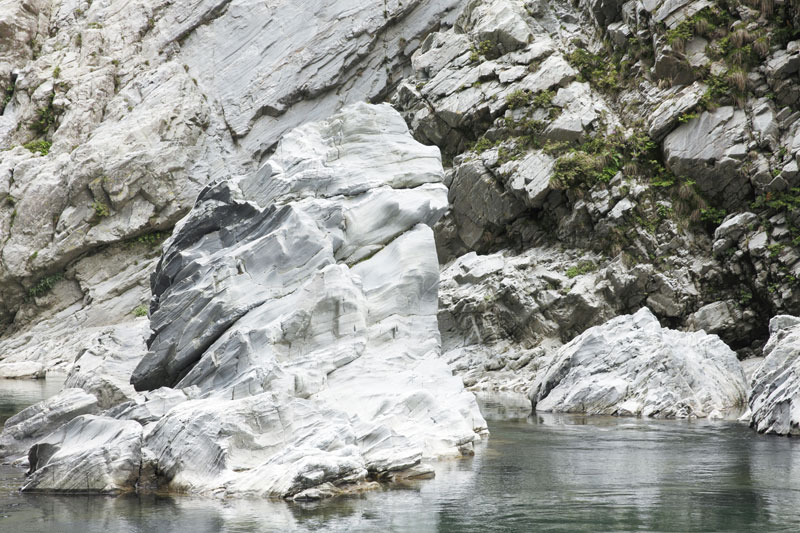
Anticline and Crenulation Fold, Quartz Veins
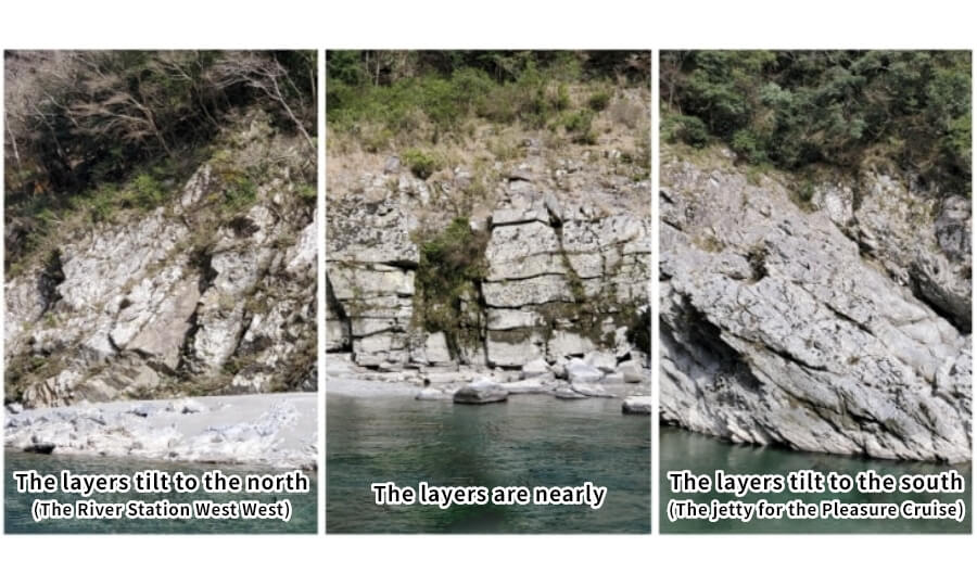
In the Oboke-Koboke Gorge, you can observe a dome-shaped large bending strata made of crystalline schist that stretches for several kilometers. Because this is a major fold in the rock layers, the geological features vary depending on where you look. For example, 1) at the downstream area near the River Station West West (a tourist rest stop), the layers tilt to the north, 2) around Dotoko the layers are nearly horizontal, and 3) near the jetty for the Pleasure Cruise, the layers tilt to the south.
Shishi Iwa Rock (Lion Rock)
Along the Oboke Gorge Pleasure Cruise route, you will spot a unique rock formation called “Lion Rock.” It looks just like a lion’s face turning to the side. If you look closely at the chin area, you will see rocks sticking out like a beard. This natural sculpture was shaped over time by the flowing river, gradually forming the face of a lion.
Hi-no-ji Valley
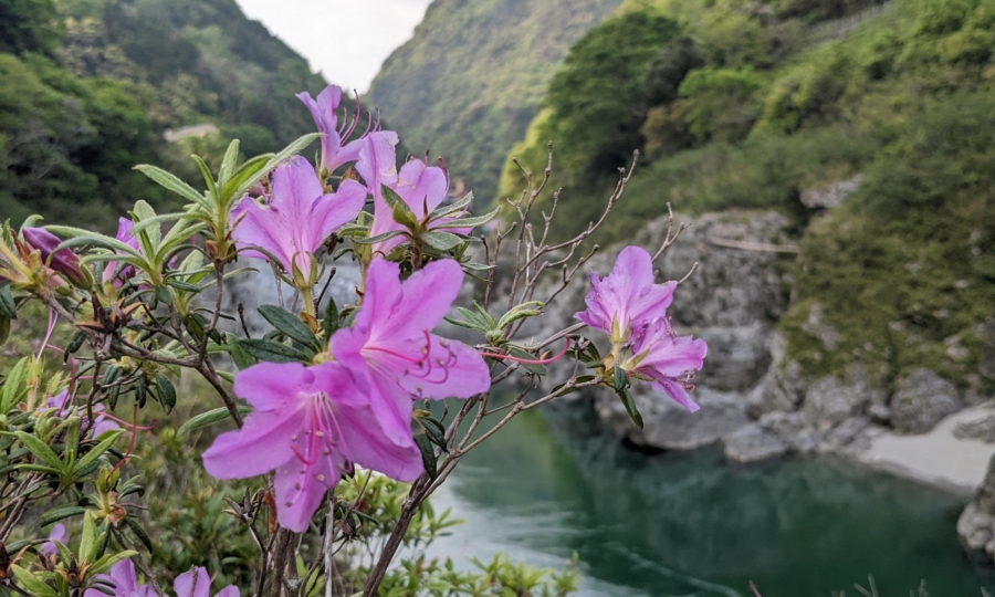
Iya Valley lies beyond Mt. Kunimi, to the east of the Oboke-Koboke Gorge. One of its most striking features is the “Hi-no-ji Valley,” a sheer cliff named for its resemblance to the Japanese letter “ひ” (hi). The winding river below curves in a way that looks like it’s writing the letter “ひ” across the landscape. This splendid scenery is carved into hard rocks such as psammitic schist, which are common in this area.
Ecosites
Ecosites are specific spots where ecosystems have been shaped by geological features and need to be protected.
Grasslands of Shiozuka Plateau
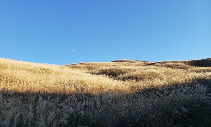
The Shiozuka Plateau is covered with Japanese pampas grass (Miscanthus sinensis), which was once used as material for thatched roofs and natural fertilizer. To maintain these grasslands, controlled burning has been practiced for many years and continues today. Thanks to this traditional method, new plants continue to grow, creating a rich habitat for insects and birds. This area is especially important for species that can only survive in grassland environments.
Flood-Tolerant Plants in Oboke
In the rocky areas of Oboke that are often flooded, you can find unique plants that have adopted to survive in these harsh conditions. To cope with the strong river currents and frequent flooding, these plants have changed their shape—some have become smaller, while others have developed longer, narrower leaves. It is fascinating to see how these tiny plants continue to thrive, perfectly adapted to their challenging environment.
Marshland and Natural Forests of Mt. Nokanoike
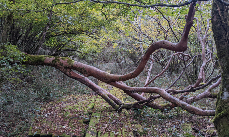
Around Mt. Nokanoike, linear depressions, formed by landslides have filled with water, creating unique marshland. The marshland is home to rare species such as bog moss (Sphagnum palustre) and Honshakunage (Rhododendron japonoheptamerum var. hondoense), the latter being a species endemic to Japan. The mountain is mainly covered with deciduous broad-leaved trees, and as you walk from the marshland toward the summit of Mt. Nokanoike, you can also observe Japanese beech forest (Fagus crenata) along the mountain pass.
- HOME
- Miyoshi Geopark Areas
- Oboke-Koboke and Iya Valley Area