-Is Mt. Tsurugi 300-million-year-old!?-
Mt. Tsurugi, Mt. Miune, and Mt. Tenguzuka Area

Into Another World Created by the High Peaks of the Shikoku Mountains

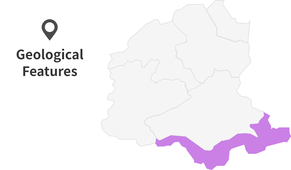
Mt.Tsurugi・Mt.Miune・Mt.Tengzuka Area
In the southeastern part of Miyoshi Geopark, you will find a range of high mountains, including Mt. Tsurugi (1955m), Mt. Miune (1894m), and Mt. Tenguzuka (1812m).
These towering peaks create conditions for strong north-south winds to blow through the area. Because of the high elevation, tall trees do not grow here. Instead, the mountains are covered with hardy grasses like Sasa and shrubs such as azaleas. The scenery changes with elevation, offering a variety of mountain views shaped by the vegetation.
Mt. Tsurugi, the highest of the three, is known as the second-highest mountain in western Japan.
Formation Processes of the High Peaks of the Shikoku Mountains
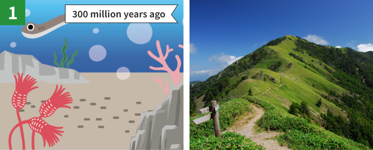
Back to 300 Million Years Ago
Around Mt. Tsurugi, you can see white limestones (e.g. Otoishi or the stone monument of Otsurugi Shrine).
These rocks contain crinoids and fossilized conodont (primitive jawless fish, a few centimeters in length) that lived in shallow, warm oceans about 300 million years ago.
These fossils are evidence that the Mt. Tsurugi was once the ocean floor a very time long ago.
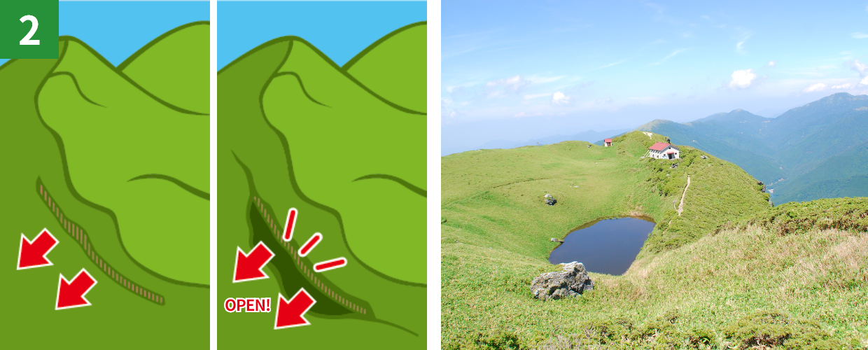
Ponds in the Peaks
There are several water-filled depressions on the mountain slopes around the peaks of Mt. Miune and Mt. Tenguzuka.
These depressions were formed because the mountain slopes were pulled down by gravity, altering the shape of the ridgeline.
Let’s all work together to preserve the landscapes and natural environment of the area. Each of us has a responsibility to protect our great Earth. Please do not litter and refrain from taking rocks and plants. Thank you for your cooperation.
*Part of this area is protected by laws and regulations. Please follow the rules to conserve the natural environment.
Site List of Mt. Tsurugi, Mt. Miune, and Mt. Tenguzuka Area
Geosites
Geosites are specific spots where geological features are found and need to be protected.
Pond at Mt. Miune
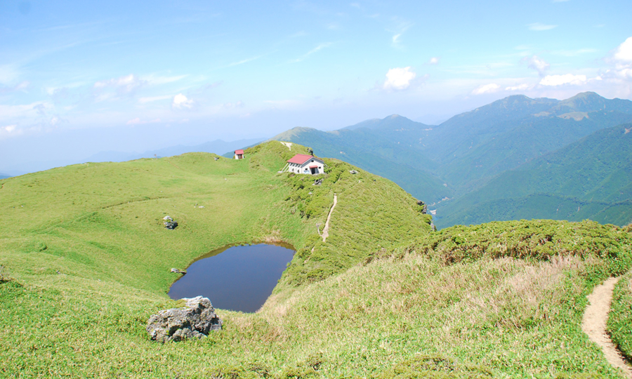
The water-filled depression at the peak of Mt. Miune form a pond. This topography is known as linear depressions formed by gravitation deformation, which the mountain slopes were pulled down by gravity, altering the shape of ridgeline.
Cultural Sites
Cultural Sites are specific spots where cultural heritage has been shaped by geological features and need to be protected.
Otoishi (Stone Monument) in Mt. Tsurugi
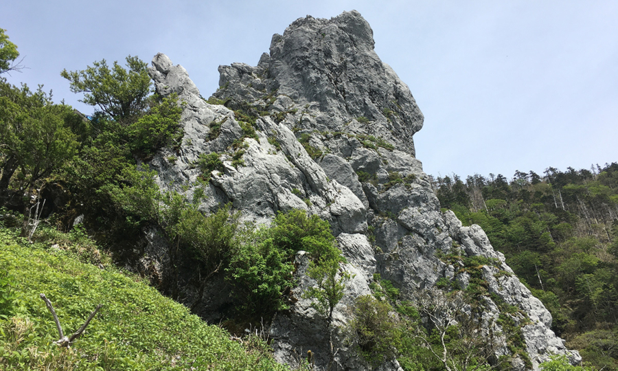
The stone monument ‘Otoishi’ is made of limestones and is an object of worship housed in Otsurugi Shrine. You can see white limestones halfway up Mt. Tsurugi, which is the consolidation remains of marine organisms that lived in shallow, warm oceans 300 million years ago.
Ecosites
Ecosites are specific spots where ecosystems have been shaped by geological features and need to be protected.
Communities of Miyamakumazasa and Kometsutsuji in Mt. Miune and Mt. Tenguzuka
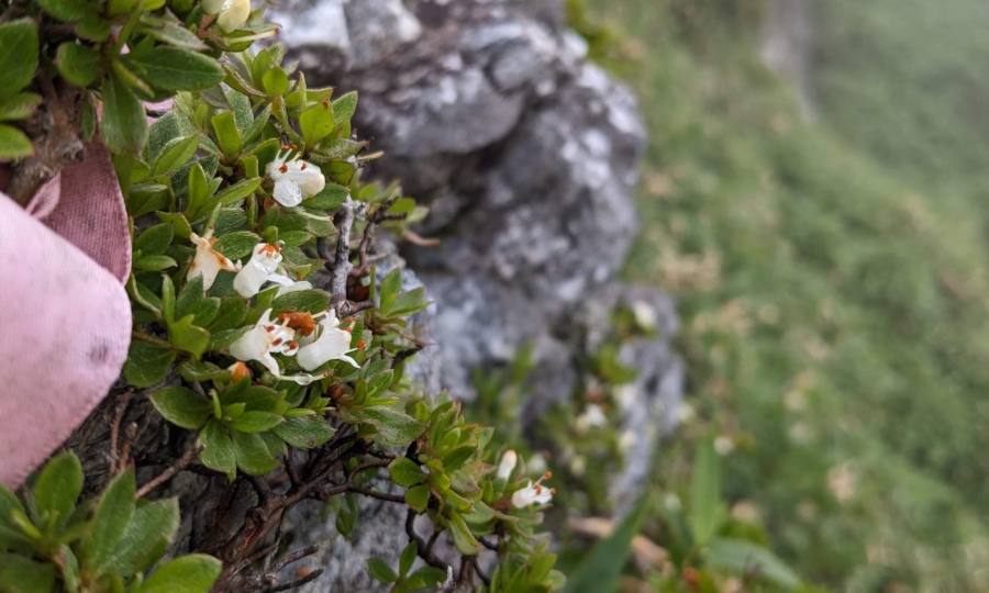
Gentle slopes formed by landslides tend to retain soil, creating suitable conditions for Miyamakumazasa (Sasa hayatae) to grow. In contrast, Kometsutsuji (Rhododendron tschonoskii), a small species of azalea thrives in rocky areas where the soil is thin. In this way, each type of vegetation seems to “know” where it belongs, depending on the conditions of the land. Because the area is exposed to strong winds, it is difficult for tall trees to grow.
- HOME
- Miyoshi Geopark Areas
- Mt. Tsurugi, Mt. Miune, and Mt. Tenguzuka Area